Five days on the Blue Ridge Parkway, milepost by milepost
469 miles at 45 mph, no gas on the road itself, and the overlooks that are actually worth putting the car in park for.
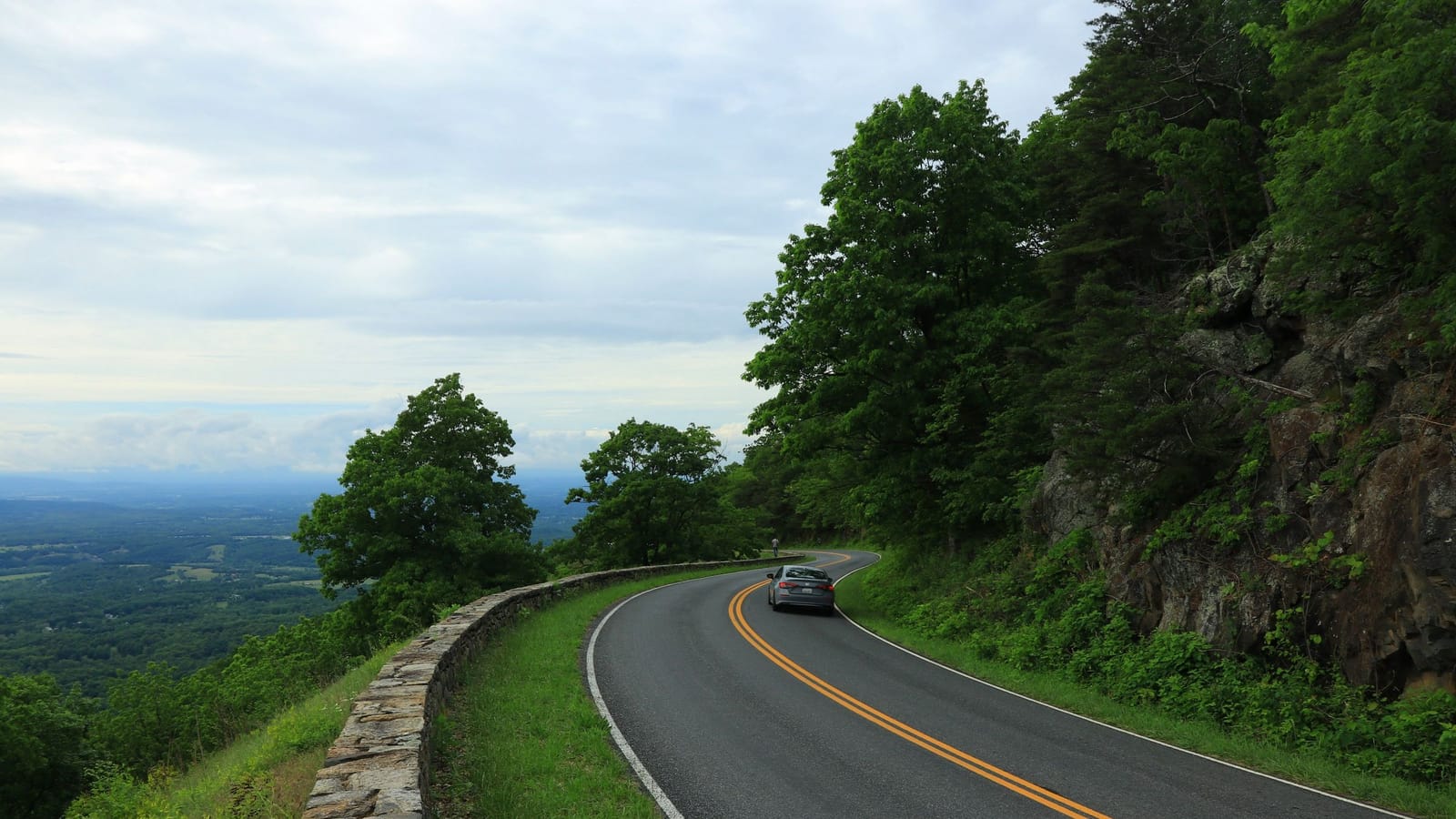
The speed limit is 45 mph and there are stretches where you won't hit it. Do the math before you book anything: 469 miles at a real-world average of about 30 mph, once you factor in overlooks, bathroom stops and the guy in the Winnebago ahead of you, is roughly 16 hours of driving. Spread over five days that's a little over three hours a day behind the wheel, which leaves you the afternoons. Try to do it in three days and you've bought yourself an expensive commute with a nice view.
Mileposts run north to south. MP 0 is Rockfish Gap outside Waynesboro, Virginia, where the Parkway picks up where Skyline Drive leaves off. MP 469 is Cherokee, North Carolina, at the door of Great Smoky Mountains National Park. Every sign, every overlook, every trailhead on the road is numbered by milepost, so stop thinking in exits and start thinking in MPs. It makes the whole trip legible.
Drive it southbound. The scenery gets bigger as you go, the elevation climbs, and you finish on the high balsams instead of starting there and spending three days coming down.
Two things that will wreck your day if you ignore them
There's no gas on the Parkway. Treat the road as a 469-mile dry stretch and fuel up in towns. You'll cross a state highway every 15 or 20 miles and there's almost always a station within a couple of miles of the ramp, but "almost always" is doing work in that sentence. My rule: below half a tank, take the next exit that has a town name on the sign.
And check the National Park Service real-time closure map the morning you leave, not the week before. Sections close for snow, ice, fog, rockslides and construction, and gates go down with no warning and no detour signage worth the name. Western North Carolina took serious storm damage in 2024 and reopening has been staged section by section, so the closure map is the difference between a scenic day and a 60-mile backtrack on county roads.
Download offline maps too. Cell service on the ridge is a rumor.
Day one, MP 0 to MP 86, Peaks of Otter
Short day. Eighty-six miles, and you'll want most of the afternoon.
Stop at Humpback Rocks (MP 5.8) for the reconstructed mountain farm — split-rail fences, a chestnut log cabin, the whole 1890s homestead. The hike to the rocks themselves is about two miles round trip and it climbs hard enough that flip-flops are a bad decision. Worth it. The view north up the valley is the first one that'll make somebody in the car go quiet.
Yankee Horse Ridge (MP 34.4) has a rebuilt section of narrow-gauge logging railroad and Wigwam Falls right off the parking area. Five minutes, no climb, good leg-stretcher for kids.
At MP 63.6 you cross the James River. That's the lowest point on the entire Parkway at 649 feet, and there's a footbridge under the road out to the restored canal locks. From there you climb almost 3,000 feet in about 20 miles, which your engine will notice.
Peaks of Otter (MP 86) is the night. There's a lodge on Abbott Lake with rooms that face the water and Sharp Top standing over the whole thing. Book it early — it's one of the only on-Parkway beds in Virginia. If it's full, Bedford is 20 minutes down VA-43 and has ordinary motels at ordinary prices.
Day two, MP 86 to MP 199, Fancy Gap
Your biggest-town day. Roanoke sits right off the road around MP 120, and it's the last real city until Asheville. Restock the cooler here. Run the detour up Mill Mountain to the star if you've got 40 minutes, because the view over the valley at dusk earns it.
Smart View (MP 154) has a one-room cabin from the 1890s and a loop trail that's genuinely easy.
Mabry Mill (MP 176) is the most photographed thing on the Parkway and you'll understand why in about four seconds. Grist mill, millpond, reflection. Get there before 10 a.m. or after 4 p.m. unless you enjoy photographing other people's elbows. The restaurant does buckwheat pancakes and the line moves.
The detour I'd actually fight for: take VA-8 down to Floyd, about 20 minutes off the Parkway at MP 165. If it's a Friday, the Country Store hosts a jamboree — old-time string bands, flatfoot dancers, no alcohol, families everywhere, and locals who've been playing together for 40 years. It's the most alive thing on this whole route and nobody's performing for tourists.
Day three, MP 199 to MP 292, Blowing Rock
The Blue Ridge Music Center at MP 213 runs midday musicians on the breezeway most of the season, free with the exhibit. Sit for 20 minutes. Then Cumberland Knob at MP 217.5, which is where construction on the Parkway started in 1935.
Doughton Park (MP 238 to 244) is high, open meadow with grazing land and long views — the Brinegar Cabin at the north end is the real thing, not a reproduction. E.B. Jeffress Park at MP 272 has the Cascades Trail, a little under a mile round trip to a stepped waterfall with a good railing and a bad drop.
Moses Cone Memorial Park (MP 294) gives you 25 miles of carriage trails around a white clapboard manor house. Walk to Bass Lake if the legs are done.
Sleep in Blowing Rock or Boone. Blowing Rock is a walkable four-block town with good dinner and no parking. Boone is bigger, cheaper, and has a hardware store if you've already broken something.
Day four, MP 292 to MP 382, Asheville
This is the day people remember. Linn Cove Viaduct at MP 304.4 curls around Grandfather Mountain on concrete piers that barely touch the ground — and the trick is that you can't see it while you're on it. Park at the visitor center just south and walk back under it on the paved path. Five minutes. Do it.
Linville Falls (MP 316.4) has three overlooks off one trail system. Erwins View is the money shot, about 1.6 miles round trip. Crabtree Falls at MP 339 is steeper and loses people on the way back up.
Mount Mitchell is the detour that isn't optional. Turn off at MP 355.4 onto NC-128 and drive five miles to 6,684 feet, the highest point east of the Mississippi. Bring a jacket in July. It runs 15 to 20 degrees colder than Asheville and the wind does the rest.
Craggy Gardens (MP 364) blooms purple with rhododendron in mid-June and is fogged in the rest of the time, which is its own kind of good.
Day five, MP 382 to MP 469, Cherokee
Eighty-seven miles and the slowest of the lot. You're above 5,000 feet most of the morning.
Pisgah Inn at MP 408.6 is the other on-Parkway lodge and the dining room has a wall of glass facing the drop. Even if you're not staying, stop for breakfast. Looking Glass Rock overlook (MP 417) shows you a granite dome that shines after rain. Graveyard Fields (MP 418.8) is a high bowl of blueberry and blackberry brush with two waterfalls and a parking lot that fills by 9:30 on weekends.
Devil's Courthouse (MP 422.4) is a half-mile of steep paved trail to a 360-degree view across four states on a clear day. Richland Balsam (MP 431) is the Parkway's high point at 6,047 feet. Waterrock Knob (MP 451.2) is the last big one, and the sunset there's the one worth planning the drive around.
Then the road drops into Cherokee and the Smokies start.
The honest part
Some of your passengers will lose interest around overlook number 40. They all start to blur — the guardrail, the bronze plaque, the blue ridges stacked back to the horizon. So don't stop at all of them. Pick eight, drive past the rest, and spend the time you save on a trail or a town instead. The Parkway rewards getting out of the car far more than it rewards looking through the windshield.
And if you're in a hurry, don't do this at all. I-81 will get you from Virginia to Tennessee in a fraction of the time and nobody will think less of you. The Parkway is for the week you decided to stop counting hours.
Pack a real cooler. There are maybe four places to buy lunch in 469 miles, and three of them close in November.
Dean Shaw
Gear & Garage
Reads the warranty, the parts list and the long-term owner reviews before anything else. Trucks, tools, watches, and the cheap version that costs more.

Watch
Worth an hour of your evening
More from Travel.
From channels we rate. Plays on YouTube.
Read next